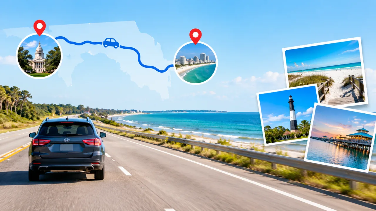
The Tallahassee to Pensacola drive covers approximately 195 miles, with an estimated travel duration of 3 to 3.5 hours. Travel is direct, with I‑10 West covering almost the whole journey. An alternate route along US-90 runs through the same general area but passes directly through town centers rather than bypassing them. Several stops appear along the way for rest, gas, and sightseeing.
- Distance: About 195 miles
- Driving time (no stops): About 3 to 3.5 hours
- Driving time (with stops): About 4 to 4.5 hours
- Advised Route: I-10 West the entire way
- Trip Length: One day
- Major Stops: Quincy, Chattahoochee, Marianna, Chipley, DeFuniak Springs, Crestview, Milton.
Tallahassee to Pensacola Distance
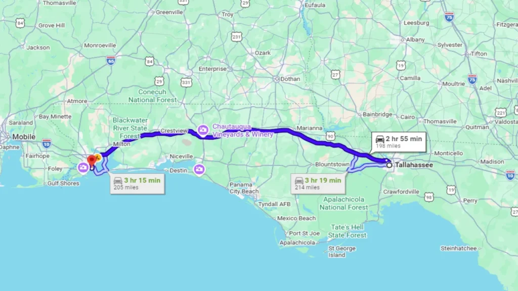
According to Google Maps, the distance from Tallahassee to Pensacola is about 195 miles, almost entirely along I-10 West. It varies slightly, between 193 and 196 miles, depending on the exact starting and ending points used within each city. By any measure, the distance between Tallahassee and Pensacola remains close to 195 miles.
Unlike some regional drives, a single interstate carries travelers the whole way. Tallahassee to Pensacola via I-10 runs directly, with no need to switch to state or US highways to complete the trip.
Tallahassee to Pensacola Drive Time
The Tallahassee to Pensacola drive time runs about 3 to 3.5 hours under normal traffic conditions, without stops. With breaks for fuel, food, or rest, total trip time typically lands closer to 4 to 4.5 hours.
- Additional factors that may add time:
Traffic near Pensacola during weekday rush hour, particularly around the I-110 interchange. - Seasonal beach traffic on weekends, especially close to the Pensacola Beach exits.
- Road construction, which appears periodically along I-10 in the panhandle.
- Morning fog over low-lying stretches near the river crossings close to Chattahoochee and Sneads.
Best Route from Tallahassee to Pensacola
Travelers can reach Pensacola from Tallahassee by two main routes, with the first being far more common since it’s faster and more direct.
Route 1: I-10 West (Direct)
This is the standard route for the Tallahassee to Pensacola drive, and the one most mapping services recommend.
How it works:
- Take I-10 West out of Tallahassee.
- Pass near Quincy and Chattahoochee; each town’s historic center is reachable via a short detour from its interstate exit, then continue through Marianna, which sits closer to the I-10 corridor itself.
- Pass through Chipley, then DeFuniak Springs and Crestview.
- Continue through Milton into the Pensacola area.
- Take the exit matching the final destination, whether that’s downtown Pensacola, the beaches, or NAS Pensacola.
This route doesn’t require any tolls for its entire length.
Route 2: US-90 (Alternate)
Some drivers choose US-90 instead of I-10, mainly to pass directly through the town centers instead of detouring off the interstate to reach them. US-90 has a lower posted speed limit than I-10 and more traffic signals through town, which generally adds 30 to 45 minutes to the trip.
Major Cities and Areas Along the Route
The Tallahassee to Pensacola drive on I-10 passes through:
1. Quincy, FL: A short detour from 1-10, about 25 minutes from Tallahassee, known for its historic downtown and preserved antebellum homes.
2. Chattahoochee, FL: A short detour from 1-10, near the point where Florida, Georgia, and Alabama meet, close to Lake Seminole.
3. Marianna, FL: On the I-10 corridor, home to Florida Caverns State Park, roughly an hour from Tallahassee.
4. Chipley, FL: On the I-10 corridor, near Falling Waters State Park, home to Florida’s tallest waterfall.
5. DeFuniak Springs, FL: On the I-10 corridor, known for its nearly perfectly round, spring-fed lake in the center of town.
6. Crestview, FL: On the I-10 corridor, a larger town about 45 minutes from downtown Pensacola (estimate; actual time depends on traffic).
7. Milton, FL: On the I-10 corridor, known as Florida’s “Canoe Capital,” set along the Blackwater River.
8. Pensacola, FL: The endpoint, with access to downtown, the beaches, and NAS Pensacola.
Places to Stop Between Tallahassee and Pensacola
Travelers making the Tallahassee to Pensacola drive may want to break up the trip at these points:
Marianna: About an hour from Tallahassee. A good spot for an early coffee or breakfast stop, with Florida Caverns State Park nearby for anyone with extra time.
Chipley: Roughly the midpoint of the trip. A natural place for lunch, with fast-food and casual dining options, including Crescent City Cafe, Chipley Station, Cancun’s Mexican Grill, and other best restaurants in Fort Lauderdale clustered near the interstate exit.
DeFuniak Springs: About 2 hours from Tallahassee. A good break for a short walk around the historic lake circle downtown.
Milton: About 30 minutes from Pensacola. A solid last stop before reaching the coast, with river access and small-town dining nearby.
Before leaving Tallahassee, consider visiting some of the city’s best places to visit and landmarks.
Things to Do Between Tallahassee and Pensacola
These require leaving the interstate for a detour; confirm current hours and admission before visiting.
- Florida Caverns State Park: Near Marianna, offering guided tours through one of the only dry, publicly accessible cave systems in Florida.
- Falling Waters State Park: Near Chipley, home to Florida’s tallest waterfall at 73 feet. The waterfall drops into a sinkhole approximately 100 feet deep.
- Three Rivers State Park: Near Sneads, set on Lake Seminole, where the Chattahoochee and Flint Rivers meet to form the Apalachicola.
- DeFuniak Springs Historic District: A walkable downtown built around a distinctive, nearly round, spring-fed lake.
- Blackwater River: Near Milton, a clear, sandy-bottomed river known for canoeing and kayaking through Blackwater River State Park.
Useful Information Before Starting the Tallahassee to Pensacola Drive
Travelers should plan necessary stops for fuel and rest before reaching Pensacola, and review parking details ahead of time if the stop is near the beach.
Fuel
Gas stations are available at most interstate exits in Quincy, Marianna, Chipley, DeFuniak Springs, Crestview, and Milton. Filling up before leaving Tallahassee or in Marianna is a safe habit, since some rural stretches space stations farther apart than on the interstate closer to Pensacola.
Rest Stops
Florida DOT maintains official rest areas along this stretch of I-10, spaced at manageable intervals for a drive of this length. Planning breaks around these, rather than searching for one mid-stretch, keeps the trip simple.
Tolls
This route doesn’t require tolls. I-10 across the Florida Panhandle, from Tallahassee to Pensacola, remains toll-free for its entire length.
Parking in Pensacola
Parking near downtown Pensacola and Pensacola Beach can fill up during peak season and summer weekends. Pensacola Beach sits across the bay from downtown via the Bob Sikes Bridge, adding roughly 15-20 minutes beyond the downtown route. Many hotels offer parking, sometimes with a daily fee, so check in advance for a beach-area stay.
Appropriate Time to Begin the Journey
Departing in the morning, ideally before 9:00 a.m., generally helps avoid the heaviest traffic near Pensacola, though conditions vary; checking live traffic before leaving is the more reliable approach, particularly on weekends during the summer beach season.
If traveling on a Friday afternoon or during a holiday weekend, expect heavier traffic near the Pensacola Beach exits regardless of departure time.
Tips for Long-Distance Driving in Florida
Keeping focus on road conditions, planning rest stops, and checking the weather can help make the Tallahassee to Pensacola journey safer.
- Observe speed limits: Rural sections of I-10 may have speed limits of up to 70 mph. Maintain a safe following distance and adjust the speed to road conditions.
- Take regular breaks: Plan to stop about every two hours and spend at least five minutes stretching and getting some fresh air.
- Refuel in advance: Keep the fuel tank at least one-quarter full, as gas stations may be farther apart along some stretches.
- Check traffic conditions: Use a navigation app before departure to identify potential delays and congestion near Pensacola.
- Prepare for summer storms: Afternoon thunderstorms are common in the Florida Panhandle during summer. Check the forecast before setting off and be prepared to adjust the travel plans if needed.
Renting a Car for the Tallahassee to Pensacola Drive
Travelers should consider a few details before booking a car rental in Tallahassee for this trip.
Choose the Right Vehicle
For a 3 to 3.5-hour drive, a midsize Sedan or SUV can provide greater comfort than a compact economy car, particularly when traveling with three or more passengers.
Check Passenger and Luggage Capacity
Before booking, verify that the vehicle has enough seating and trunk space for everyone and their belongings. This is especially important if carrying beach gear or multiple suitcases.
Consider Fuel Efficiency
With a distance of approximately 195 miles each way, fuel expenses can add up over a round trip. Choosing a fuel-efficient vehicle can help keep overall travel costs under control.
Review the Rental Agreement
Before pickup, confirm the mileage limit, one-way drop-off options in Pensacola, toll policies, and roadside assistance details. One-way rentals between Tallahassee and Pensacola often carry an additional drop-off fee, and availability varies by provider; confirm this directly rather than assuming it’s included.
Plan Ahead for Parking
Although tolls are not a concern on this route, parking fees may apply near Pensacola Beach and downtown Pensacola. If the destination is in a busy area, check parking availability and rates in advance, and ask the rental company for any relevant local parking advice.
The Tallahassee to Pensacola drive is a one-day trip. The recommended route follows I-10 West for the entire distance, with an estimated travel time of 4 to 4.5 hours including rest stops. Suitable break points include Marianna, Chipley, and DeFuniak Springs. With some planning around fuel, rest, and weekend beach traffic, the drive from the capital to the Gulf Coast stays direct from start to finish.
Frequently Asked Questions
Tallahassee is about 195 miles from Pensacola by road, almost entirely along I-10 West.
The distance doesn’t change, but seasonal weather, construction, and weekend beach traffic can add time; checking current conditions before leaving is important.
The drive takes about 3 to 3.5 hours without stops. With breaks, plan for 4 to 4.5 hours.
I-10 West is the most direct and commonly used route, covering the entire distance without a highway change.
No, I-10 across the Florida Panhandle doesn’t require tolls on this route.
Yes, most drivers complete the Tallahassee to Pensacola trip in under 5 hours, including stops.
Marianna, Chipley, DeFuniak Springs, and Milton all make convenient stopping points for gas, food, or a short break.
Before 9:00 a.m. is best, especially on weekends; checking live traffic before leaving is still the most reliable approach.
That depends on the rental company’s policy for one-way rentals from Tallahassee. Confirm with the rental provider before booking if returning to a different city.